"With the core GIS software, we have been working with technology for utility management"

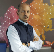
Agendra Kumar, President Esri India Technologies
Started in 1969, Esri is a more than 50 years old global company. Esri India Technologies was formed in 1996. In India, government organizations have been using their software since 1980s. With a fairly large customer base, Esri India works with national mapping organizations like Survey of India, Geological Survey of India and National Thematic Mapping Organization which prepare authoritative maps of a country for the use of the people in the country.
Various ministries that come under Government of India are using the company’s software. A lot of departments which comes under Department of Science and Technology, DRDO, Defence organizations,Forest Survey of India, many statistics organizations are using Esri’s software.They work closely with the states like Rajasthan, Jharkhand, Orissa, Punjab, Haryana and West Bengal. In a chat with VARINDIA Agendra Kumar, President Esri India Technologies has explained about their GIS software, their roadmap and the difficulties faced by them.
How are you leveraging the GIS technology across the different industry verticals?
A. The companies use the GIS software which is Geographical Information System in managing water resources, managing forest, road transportation, electricity distribution etc.Under the Smart City program there are around 35 Smart Cities using their software. Bhubaneshwarwas number one in the city which started using the software right in the beginning.
Solid waste is a big challenge in the country, improving traffic situation, managing the road condition, drainage systemsand water distribution are major challenges. They try to use GIS for parking as well,and other municipal corporations which are not part of smart city programs, but they are quite big like GMDA, MCGM, they've been using our software for quite some time. Drainage is most important, which is municipal applicant area like water distribution, drainage waste collection,managing the utilities. A lot of manufacturing organizations use our software to manage theirdistribution, logistics, location of analytics about location of their customers, factories, distribution points. Large telecommunication companies use our software to improve the quality of the network. Some of those organizations use our software in education sector also. There are hundreds of education institutes which are using our software as some of them have specialized programs in geo informatics, teaching to civil engineering students or geography students or computer science students.
How GIS is creating opportunity in the country to attain sustainable growth?
Water, forest departments, pollution control are most important areas. Some cities are installing sensors to capture the real time information which comes to a GIS platform and they can monitor which areas are more polluted, and then they can make decisions.
What is thenext big thing in the GIS?
A lot of thing is coming in GIS as it is a very happening field. We have recently launched a global app which provides information about all the countries. In India, our GIS software always had some capabilities of Artificial Intelligence. But now it has become matured and more important.In urban development, traffic management, availability of resources like water and electricity, medical facilities, education, health are big areas where GIS play a major role.
What is the substantial growth agenda of your company?
We are a leader in this areahaving the largest market share. We have a fairly strong technical support for our customers and have a very high satisfaction level among our customers. We have tried to create a base of partners and have created different levels of partners. We have about 75 companies who we are supporting as startups.We have close to 30 Indian ISP partners who are creating a software product based on technology, we have around 70 to 100 resellers for our software and we have a tie up with Reddington, our master reseller.We also have partnership with large SI companies, for example, Honeywell or L&T or Tech Mahindra.
What is the future plan of 2020?
We see a lot of growth coming fromstate governments,but mainly in east and north-east sectors we see a lot of work coming in. We also expect growth in few northern states as well like Punjab, Haryana and Himachal Pradesh.We see opportunity in Jammu and Kashmir with the changes which have happened now. Government is looking at focusing and investing more in that area.
Through which business model are you penetrating the Indian market?
Our business model is basically depends on a lot of partnerships. Globally, Esri is a company that works with a large number of partners. With the core GIS software, we have been working with technology for utility management. GIS is highly data centric application, so we work with many companies who help us in creating data. We are creating an ecosystem integrating a community of companies who can leverage on each other's strengths and provide a solution to the customer. That's the model that we are trying to promote.
Focusing on education sector, Esri India has taken an oath to create GIS trained manpower in the country. They are facing this demand from smart cities. So they want to work with education sector, to ensure that students should learn at least basic of GIS.
See What’s Next in Tech With the Fast Forward Newsletter
Tweets From @varindiamag
Nothing to see here - yet
When they Tweet, their Tweets will show up here.


